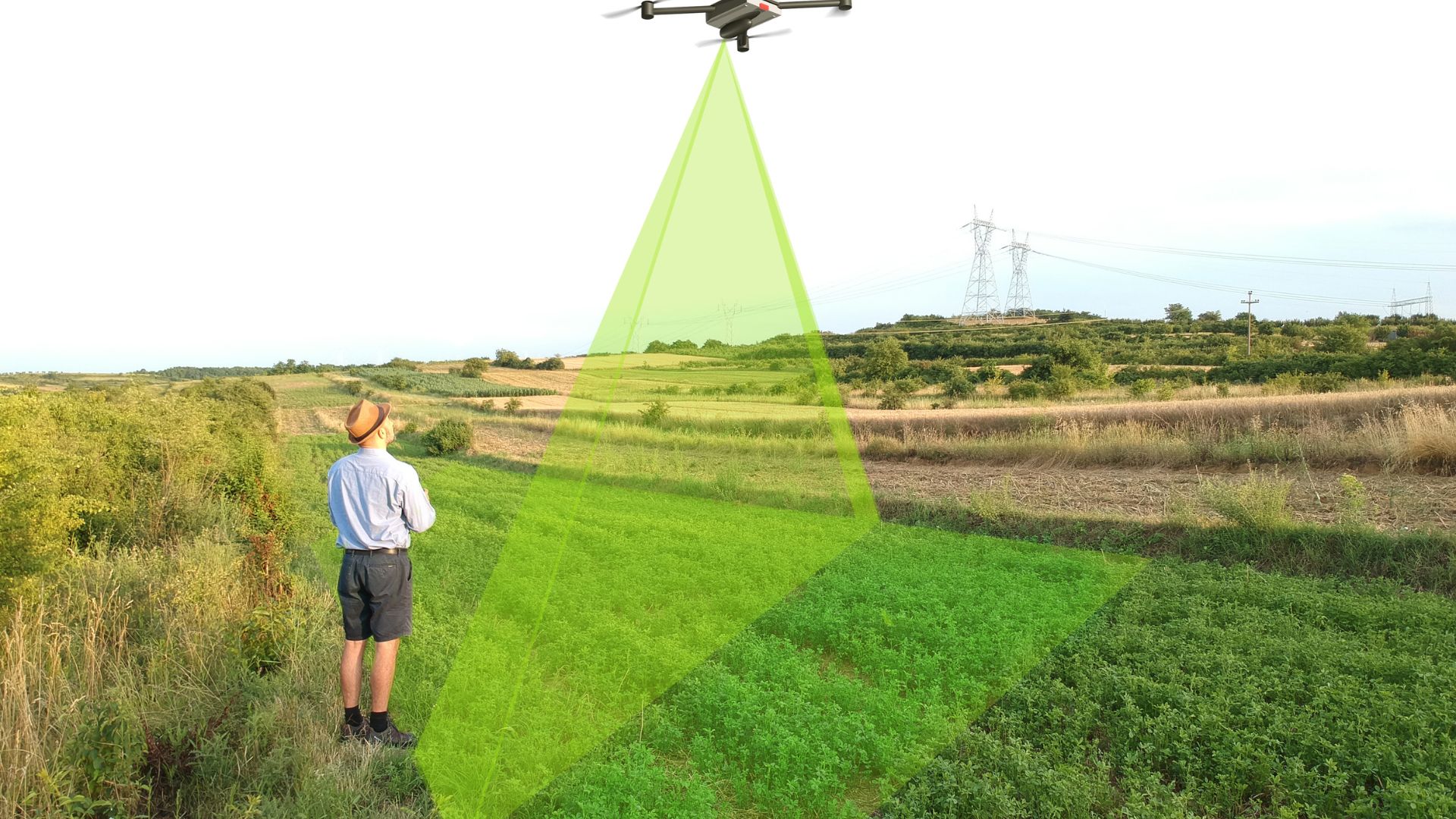
Precision Drone Surveying & Aerial Mapping Services – Advanced Imaging Solutions in the Upper Peninsula
Experience unparalleled accuracy and efficiency with our advanced drone surveying and mapping services.

Enhance Emergency Preparedness with Our Escape Route Drone Mapping Services
Escape Route Drone Mapping is crucial for effective emergency planning and safety. Our advanced drone technology provides precise mapping to ensure quick and safe evacuations.
Safety First
Identify the fastest routes for safe evacuations during emergencies.
Expert Mapping
Utilizing drones for accurate and timely escape route analysis.
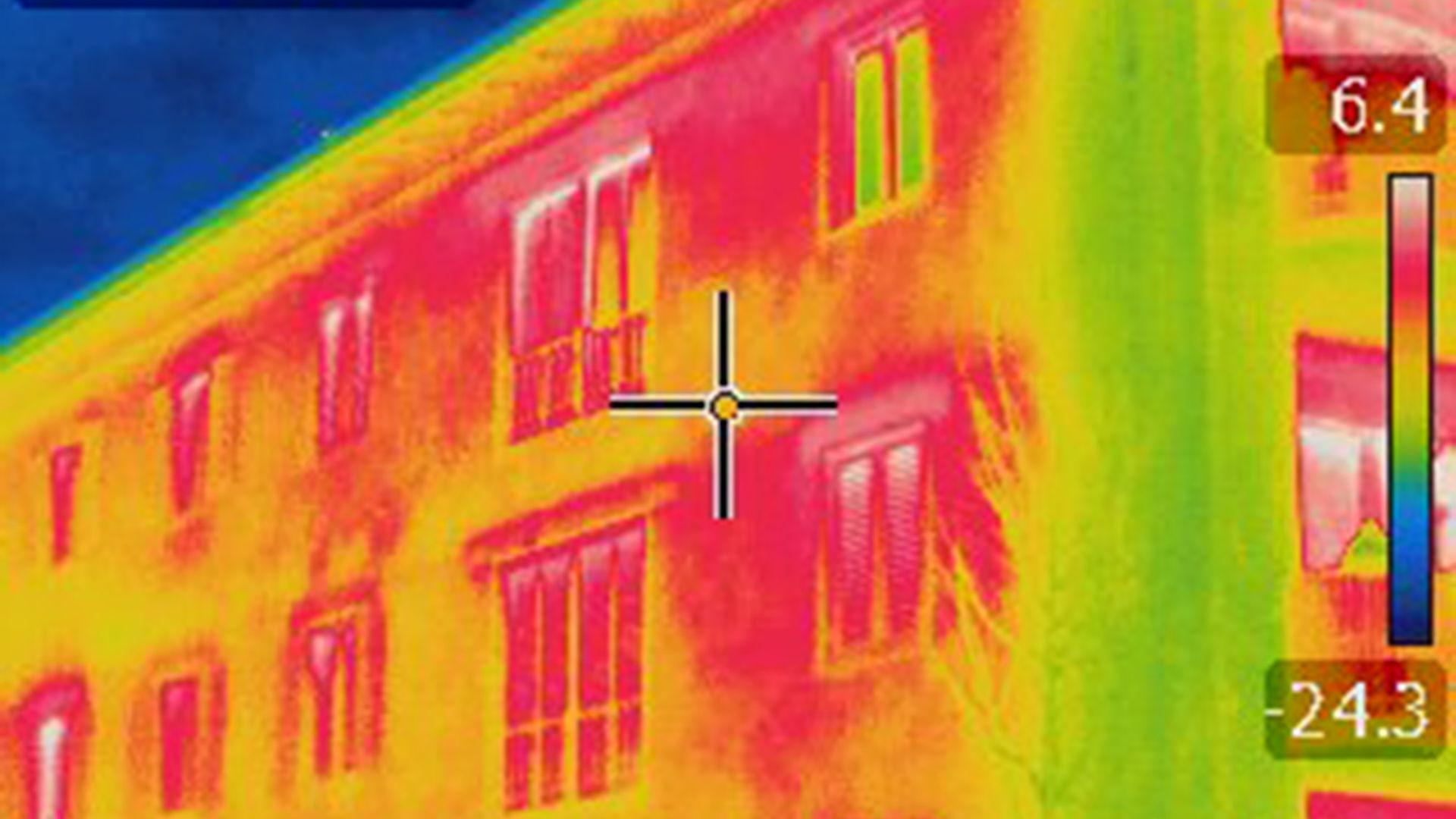
Revolutionizing Surveying with Advanced Thermal Imaging Drone Technology
Our thermal imaging drone services provide unparalleled insights for industries such as construction, agriculture, and environmental monitoring. With precise data collection and real-time analysis, we help you make informed decisions that enhance efficiency and safety.